Technical climbing info
- Mountain: Le Petit Cheval
- Elevation: 6,500′
- Route: Spontaneity Arete
- Length: 1,800′
- Grade: III, 5.7
Preamble
Most of the climbs I choose to share about are amazing, and I love sharing them so other people can feel the confidence to go feel that amazing experience as well. Some are so bad that I just want to forget, and some are just forgettable, neither of which usually make it to this blog. And then, some….some are just annoying. This one, dear readers, was just annoying.
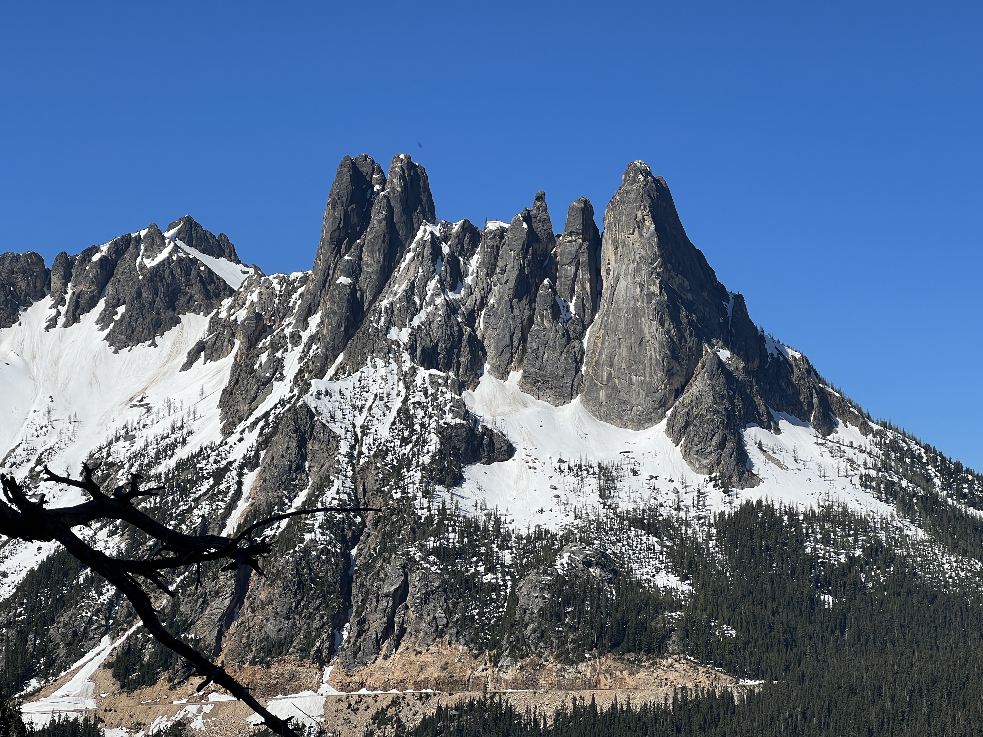
It had been the year of precipitation, and the weather finally cleared up. We had been itching for Washington Pass, and climbed NEWS’ Chockstone Route as a warmup a couple days before. Le Petit Cheval’s Spontaneity Arete drew us in as a mini North Cascades adventure. Nelson gave it 4 stars, so we were excited!

Approach
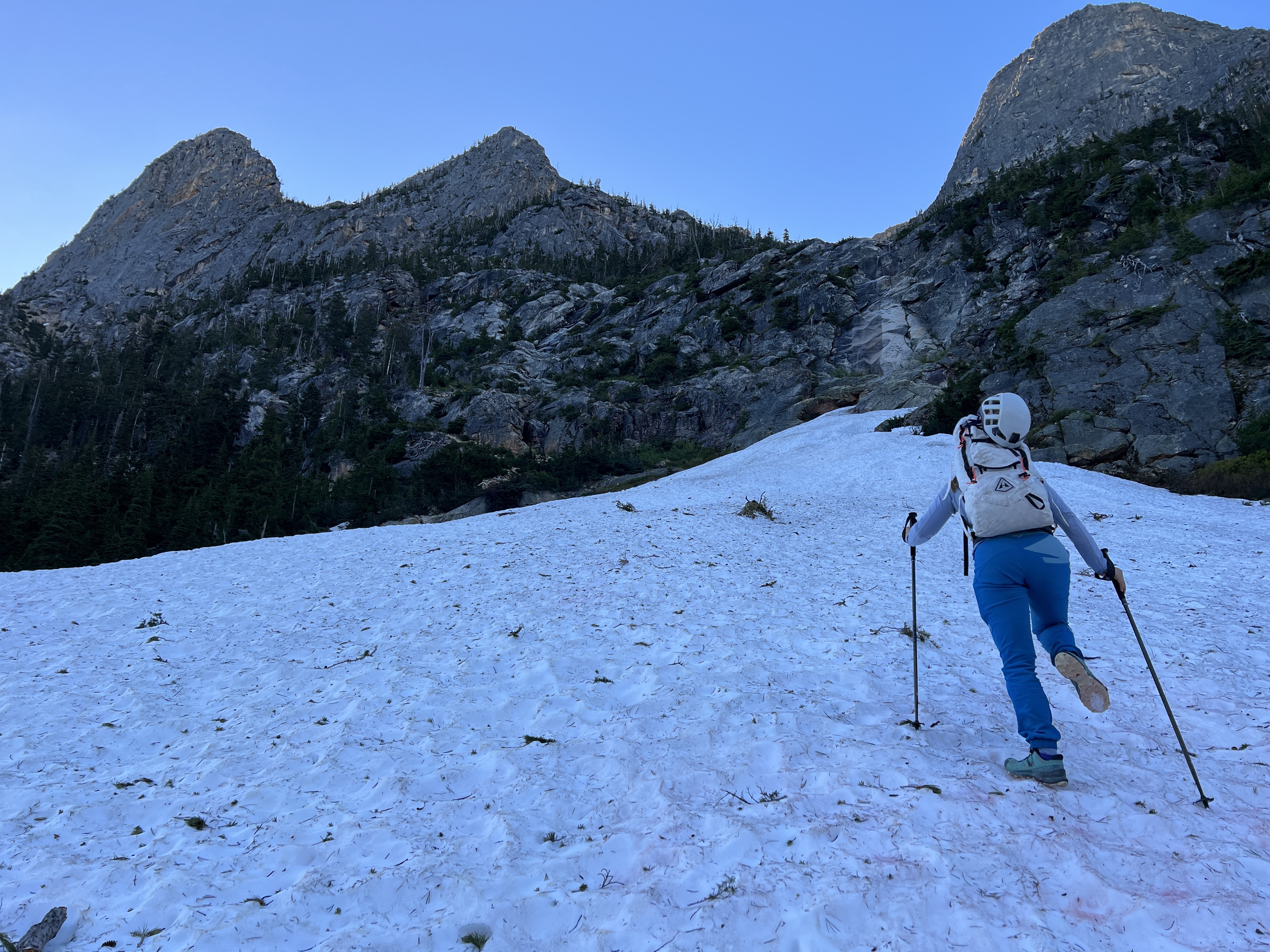
The good commenters of Mountain Project seemed to hate this route for the approach and the descent. We honestly were a little worried, and even came out the day before to visually inspect the route from the road. It looked “okay”, but we were a little concerned because of the comments. We figured we’s just sleep early and start when the sun had just risen.
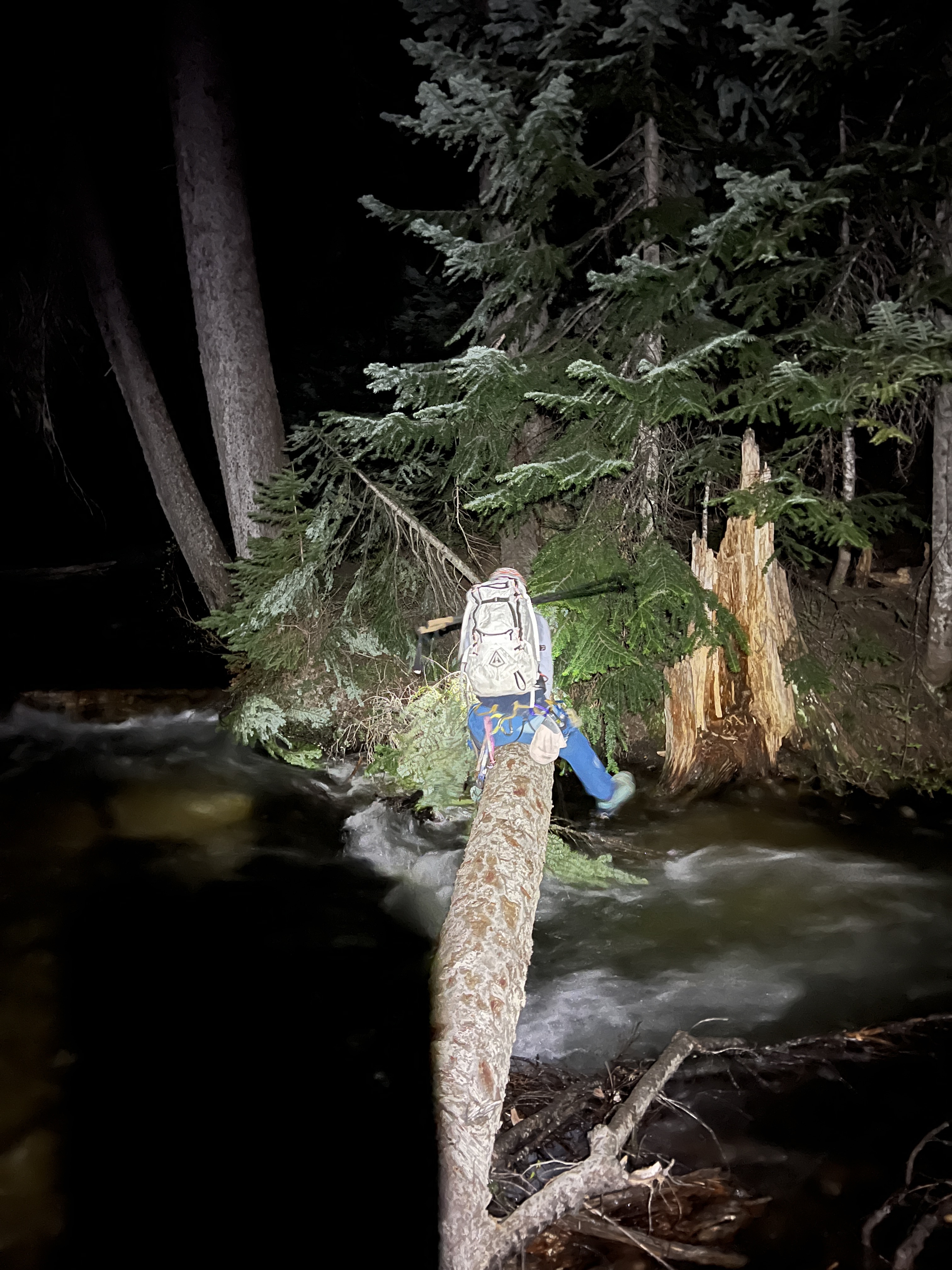
The trail was actually not bad at all, by North Cascades standards at least, and we fairly rapidly found ourselves at the river crossing. The tail’s river crossing wasn’t too bad either, and just a few minutes to the left was a far better one. We humped our way across two logs, far better than the fording option many people talk about.
We exited the tree line fairly quickly, exiting the forest with basically zero route finding challenges. We were feeling pretty confident! We had a GPS trace (link at the end of this post) that was serving us pretty well. We made our way inspecting every weird looking tree and crack to try to determine the base of pitch 1.

Is this Pitch 3..?
The confusion began when we scrambled over some loose choss and somehow found ourselves at the top of pitch 2. What the heck..? Pitch 3 was also nowhere in sight. Huh?
Okay, well, it was still early-ish, and we really wanted to experience the entire climb. We geared up and rapped pitch 2 and 1 in the attempt for a do-over. We hiked around the base of the rap and eventually found pitch 1 a few minutes away. Sweet.

Pitch 1 and the Pac Man Pitch
While middle annoyed by the situation, we were happy with the fun moderate climbing that we found on pitch 1. Jess led her way up, and I followed along in a short but clean pitch. The real thing we were looking forward to was pitch 2, ie. “The Pac Man Pitch”, which has climbers traverse through what looks like the mouth of a giant Pac Man. Jess still had most the gear, so she lead us through the mouth back up to where we had rapped from not too long ago.

Locating Pitch 3
Now that we were back to where we had left off, we still needed to figure out where the heck pitch 3 started. We walked into the choss gully below us and started walking our way upwards. I wished I brought my trail runners for this, because doing it in my “comfort fit TC Pros” was still annoying. Far later than we expected, we located the base of pitch 3.


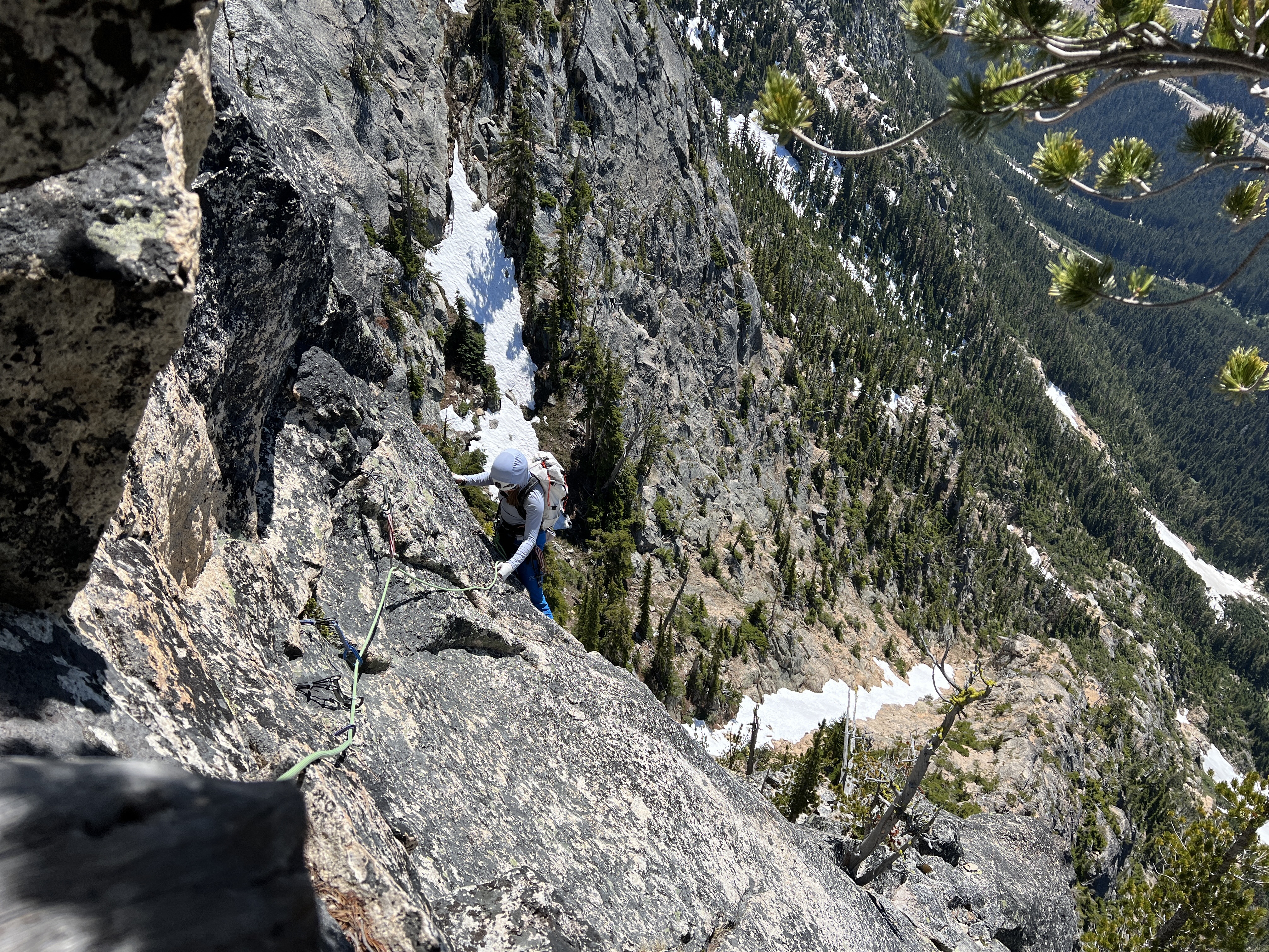
Pitch 3-8, the Money, the Meat
The money pitches really happen here, which is the meat of the climb. Jess was on a roll leading, so she made her way up pitch 3, which was a bit harder looking than either of expected. Upon further investigation, I believe that we took a slightly harder variation than we had to, but it was fun nonetheless.
We swapped leads from there, which really was the meat of the climb. It went by fairly fast, all nicely positioned with nice views of the Liberty Bell group and the pass to our left.

The “Summit”
All too quickly, I found myself leading onto a gentle ridge with what looked like a bivy spot. I felt like I needed more climbing, but we knew that finishing the ridge would mean descending the gully on foot, plus it was mostly just walking terrain at that point, some of which would still be snow covered.
Reaching the hight of the route, which was slightly off of the summit, was kind of an inglorious way to determine that we had reached our “summit” for the day. But that was the route, and it was time to turn it around.
We rigged up to the rap station and made our way down.
The Descent
The one thing that people on Mountain Project seem to have ever agreed upon, in the history of time, is that the descent of this route sucks. I didn’t quite get it going up, but we quickly realized why on our way down.
The raps all seemed to be a little wandery, and seemingly always wanted to pull me off into a different direction. I brought a good amount of cord and some burner carabiners, knowing we were early in the season. I backed up a few crispy anchors and created some new ones that would be easier for climbers of the future to use, I hoped.
Eventually we found our way at the top of p3, and felt we had the meat of the raps behind us. Little did we expect, the route had a different plan in mind for us. As we pulled the rope, it got twisted around over a series of flakes. Dammit. We tugged and tugged, but nothing. Gahhh. It was starting to get late, and we both had run out of water. Jess begrudgingly made her way up, leading off the back end of the rope to free the tangle.
Time to pull again. DAMMIT. The rope tangled around the same series of flakes.. I considered whether or not we could get down the rest of the route if I cut the rope, we’d have about 45m. I remembered the first 2 raps being real rope stretchers. Gahhh. Jess begrudgingly made her way up again, and this time created a new rap station.
We made our way back down to our backpacks at the top of p2 and drank the rest of our stashed water. We rapped the 2 familiar pitches, and booked down the choss trail, rapping the hand lines. We were still thirsty and it was getting dark.
We located a little waterfall and filled our bottles. The previous year I got really sick on the North Ridge of Baker from drinking untreated water; lesson learned, this time we treated it. (Here’s an older trip report of the NR when I didn’t get sick.)
We got to a familiar snow field close to the base of the peak, only to find that our footprints had melted out over the warm day. We approximated our way down via GPS and memory, but now dark, couldn’t find the trail on the other side of the snow. Not wanting to waste anymore time, we made the decision to bushwhack the forest until we found the river we had crossed.
The North Cascades forest is thick, very thick. I didn’t want to spend the night there whatsoever, and we knew our headlamps had limited batteries, so we moved quick through the bush. Our GPS continued to be useless in locating a trail, so we just walked in the general direction of the sound of the river. Eventually, we found ourselves just a few (critical) meters off the trail and at the logs we had crossed that morning.
We humped our way back over the river, now with much higher water. My foot went in the river by accident, but it felt good. From there we were just a few minutes away from the parking lot. Finally.
In conclusion
Overall, this really didn’t feel like a “climb” as much as it felt like a “mountain adventure with a bit of climbing”. It would be a fairly quick and easy outing if we had to repeat it and knew where we were going, but the climbing felt disjointed and just wasn’t amazing enough for me to want to repeat.
If you do choose to go on this “mountain adventure with a bit of climbing”, I recommend that you check out this blog post on Andrew’s Hikes for high quality photo beta and a GPS trace.